Agricultural apps
When should you plant? Is the rain likely to arrive this week? Are your crops showing signs of disease? Should you irrigate today or wait until tomorrow? Which market offers a better opportunity to sell your harvest?
For generations, farmers have answered these questions through experience, observation, advice from fellow farmers, and information from agricultural extension workers. These traditional sources of knowledge remain valuable. However, changing weather patterns, rising production costs, pest outbreaks, and increasing pressure to produce more food have made timely information more important than ever.
This is where agricultural apps come in.
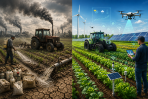
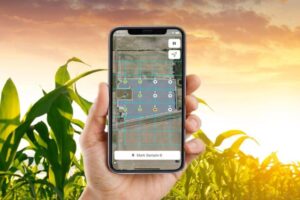
Agricultural apps are mobile or web-based tools that help farmers access information, monitor crops, check weather forecasts, manage farm activities, identify potential plant problems, and make more informed decisions. Some applications focus on weather forecasting, while others help users identify crop diseases, record farm expenses, monitor vegetation, or connect with agricultural experts.
For Nigerian farmers, these tools can be particularly useful because farming conditions differ significantly across the country. A farmer cultivating rice in Kebbi may have different water-management needs from a vegetable grower in Lagos or a maize farmer in Kaduna. Similarly, rainfall expectations and planting seasons vary between the humid southern states and the drier northern regions.
The good news is that farmers do not necessarily need expensive equipment or sophisticated computer systems to benefit from agricultural technology. A smartphone, a reliable source of weather information, and a suitable farming application can provide a practical starting point.
Nevertheless, not every app serves the same purpose. Some provide general weather forecasts, others offer satellite-based crop monitoring, and a few combine several agricultural services in one platform. Certain applications are free to use, while others require subscriptions or offer advanced features at a cost. Availability, language support, mobile data requirements, and suitability for Nigerian farming conditions also deserve careful consideration.
This guide examines 10 useful agricultural apps and digital tools that Nigerian farmers can explore in 2026–2027. It explains what each tool does, how it can help, its potential limitations, and the factors to consider before relying on it.
The goal is not simply to encourage farmers to download more applications. It is to show how the right combination of digital tools can support better crop management, reduce avoidable losses, improve planning, and help farmers make decisions with greater confidence.
What Are Agricultural Apps and How Do They Help Farmers?
Agricultural apps are digital tools designed to make farming activities easier to plan, monitor, and manage. They can work on smartphones, tablets, and computers, depending on the platform.
Some applications are designed specifically for farmers, while others are general-purpose weather, mapping, or satellite-data tools that can also support agricultural decisions.
For example, a maize farmer can use a weather application to check whether heavy rainfall is expected before applying fertilizer. A cassava farmer can use a crop-diagnosis app to investigate unusual leaf symptoms. A commercial vegetable grower can use satellite imagery to understand the layout of a large farm, while a farm manager can use a record-keeping application to track production costs.
The value of these applications lies in the information they provide and how that information is used.
Major Types of Agricultural Apps Nigerian Farmers Should Know

1. Crop monitoring apps
These applications help farmers inspect crop health, identify possible diseases, record field observations, and monitor changes in crop growth. Some use artificial intelligence to analyze photographs of affected plants.

2. Weather forecast apps
These tools provide information about rainfall, temperature, humidity, wind, and possible severe weather. Farmers can use forecasts to plan planting, irrigation, spraying, fertilizer application, and harvesting.

3. Satellite and farm mapping tools
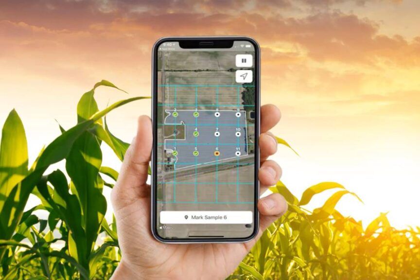
These tools provide aerial imagery, geographical information, and, in some cases, measurements of farm boundaries or vegetation conditions. They are especially useful for larger farms and agricultural advisers.

4. Farm management apps
These applications help users record expenses, sales, inventory, labor, production activities, and harvests. They can make it easier to calculate whether a farming operation is profitable.

5. Digital agricultural advisory apps
These tools provide farming guidance, answer agricultural questions, and help farmers access information about crops, livestock, pests, fertilizers, and production practices.
Not every application offers all these features. Before choosing one, farmers should identify their most urgent needs and select tools that address them.
Why Farming Apps in Nigeria Matter in 2026–2027
Nigeria’s agricultural conditions make timely information particularly valuable. Rainfall distribution varies by location, farming systems differ across regions, and the costs of seeds, fertilizer, labor, transportation, and other inputs can significantly affect profitability.
Technology cannot eliminate these challenges, but it can help farmers make more informed decisions.
1. Farming apps help farmers plan around changing weather
A farmer who depends entirely on rainfall may lose valuable planting time if the first showers are followed by a prolonged dry spell. Planting too early can expose young crops to moisture stress, while planting too late may shorten the period available for crop development.
Weather forecast apps can help farmers assess expected rainfall and temperature before making planting decisions.
For example, a farmer growing maize in Kaduna might check a local forecast before preparing to sow. Rather than relying on a single prediction, the farmer can compare forecasts over several days and observe actual rainfall conditions in the field.
The important lesson is that a forecast supports a decision; it does not replace local knowledge of soil moisture, planting calendars, and crop requirements.
2. Crop monitoring apps can help identify problems earlier
Crop problems are often easier to manage when they are detected early. Yellowing leaves, unusual spots, wilting, damaged stems, and stunted growth can indicate different problems, including nutrient deficiencies, diseases, insect attacks, or water stress.
Some crop monitoring apps allow users to photograph affected plants and receive possible diagnoses or treatment suggestions.
This can be particularly useful for farmers who cannot immediately reach an agricultural extension officer. However, an app’s result should be treated as an initial assessment rather than a guaranteed diagnosis.
3. Agricultural apps can support better water management
Water is essential to crop production, but both shortages and excesses can damage crops. Too little water may reduce growth, while excessive rainfall or irrigation can contribute to root problems, nutrient losses, and waterlogging.
Weather information, soil observations, and satellite-based agricultural data can help farmers plan water use more carefully.
The Food and Agriculture Organization’s WaPOR platform provides open-access, satellite-derived information related to agricultural water productivity and land and water management. It is particularly relevant to agricultural researchers, irrigation planners, and technically equipped farm managers.
4. Farming apps can reduce avoidable production costs
Agricultural inputs cost money, and applying them at the wrong time can waste resources. If heavy rainfall is expected shortly after fertilizer application, for example, a farmer may need to reconsider the timing based on the fertilizer type, crop needs, soil conditions, and professional recommendations.
Similarly, recording expenses in a farm management app can reveal where money is being spent unnecessarily.
The aim is not to spend less on every input regardless of its value. It is to use labor, fertilizer, water, fuel, and other resources more effectively.
5. Digital tools can make farm records more useful
Many farmers know how much they spent on a farming season but do not have a complete record of what each crop, field, or production cycle earned.
Farm management applications can organize these figures, making it easier to compare planting seasons, estimate production costs, and plan future investments.
For farmers who want to expand, reliable records may also help when discussing financing, partnerships, or business opportunities.
10 Best Agricultural Apps in Nigeria for Farmers in 2026–2027
The following list combines crop-diagnosis applications, agricultural advisory tools, weather platforms, mapping services, and farm management software. They serve different purposes, so they should not be treated as interchangeable products.
Availability, supported crops, features, and pricing can change. Nigerian farmers should verify current app availability and local suitability before relying on any tool.
1. Plantix: One of the Best Crop Monitoring Apps for Nigerian Farmers

Plantix is a crop-diagnosis and farming-advisory application that helps users investigate possible plant diseases and other crop problems. It is particularly relevant to farmers who want to use smartphone photographs as a starting point for identifying visible symptoms.
The platform describes features for photographing affected crops, receiving possible diagnoses, exploring treatment suggestions, and accessing agricultural knowledge.
How Plantix can help Nigerian farmers
Imagine that a farmer growing tomatoes notices dark spots spreading across several leaves. Without an immediate diagnosis, the farmer might purchase a pesticide that does not address the actual problem.
A crop-diagnosis tool can help narrow down possible causes and suggest what to investigate next.
Plantix may be useful for:
-
Identifying possible crop diseases from photographs.
-
Investigating visible symptoms on supported crops.
-
Learning about crop health and disease prevention.
-
Exploring treatment options for suspected crop problems.
-
Obtaining additional agricultural information when a problem appears.
For farmers growing vegetables, maize, and other supported crops, this type of tool may be a useful addition to regular field inspections.
How to use Plantix effectively
First, inspect the affected crop and take a clear photograph in good lighting. Include the affected leaves or other plant parts and, where possible, examine whether the problem appears on one plant or across an entire section of the farm.
Follow the app’s instructions and review its suggested diagnosis. Then compare the result with the crop’s growing conditions, recent rainfall, fertilizer history, and any signs of insects or disease.
If the symptoms are severe or spreading rapidly, consult a qualified agricultural extension officer or crop specialist before applying chemicals.
Limitations Nigerian farmers should consider
A photograph does not always reveal the complete cause of a crop problem. Several diseases and nutrient deficiencies can produce similar symptoms, and image quality can influence the result.
Farmers should also check whether the app supports their particular crop and whether its recommendations are suitable for local conditions.
Best for: Farmers who want digital assistance with visible crop problems and basic crop-health education.
2. FarmerChat: An Agricultural Advisory App for Farming Questions

FarmerChat, developed by Digital Green, is an agricultural advisory tool that allows farmers to ask questions about farming and access practical guidance.
Its current app listing describes support for topics such as crop diseases, pests, fertilizer use, weather, irrigation, livestock, and agricultural knowledge. The listing also identifies Nigeria among the countries where farmers use the service.
What makes FarmerChat useful?
Farmers frequently need answers to everyday questions. A maize farmer may wonder why leaves are turning yellow. A poultry farmer may need help understanding a change in flock behavior. A vegetable grower may want to know how weather conditions affect irrigation.
An agricultural advisory tool can provide an accessible starting point for exploring such questions.
Potential uses include:
-
Asking questions about crop cultivation.
-
Investigating possible pest and disease problems.
-
Learning about fertilizer use and crop care.
-
Seeking guidance on weather and irrigation.
-
Exploring livestock management information.
-
Accessing farming knowledge through supported language and interaction options.
For Nigerian farmers who have limited access to agricultural specialists, digital advisory services can help bridge some information gaps.
How Nigerian farmers can benefit from FarmerChat
Consider a farmer growing maize in Benue State who notices yellowing leaves after a period of heavy rain. The farmer can describe the crop’s age, soil conditions, recent fertilizer application, and visible symptoms.
The quality of the information provided matters. A detailed description, supported by a clear photograph when the application accepts images, may help produce a more relevant response.
The farmer should then compare the guidance with field observations and, when necessary, consult an extension professional.
Important limitations
An AI-generated answer can be incomplete or incorrect. A symptom may have several possible causes, and a general recommendation may not account for local soil conditions, crop varieties, pesticide labels, or Nigerian regulations.
Do not treat an AI response as a substitute for a professional diagnosis when a crop is at serious risk. Always verify pesticide and fertilizer instructions before use.
Best for: Farmers seeking accessible agricultural guidance on crop production, pests, livestock, and related questions.
3. PlantVillage Nuru: Crop Monitoring Apps That Can Work Offline
PlantVillage Nuru is an AI-powered crop-diagnosis application designed to help users identify certain crop pests and diseases in the field. Its documented crop focus includes cassava, maize, sweet potato, and potato.
The Technologies for African Agricultural Transformation (TAAT) catalogue describes Nuru as supporting in-field diagnosis and notes that it can operate offline for supported diagnostic tasks. It is available as a free application through Google Play according to that catalogue.
Why offline crop diagnosis matters
Internet access is not equally reliable in every farming community. Some farmers work far from towns where mobile coverage is stronger, while others must manage their data expenses carefully.
An application that can perform supported tasks without an active internet connection may be useful in these circumstances.
However, offline capability does not necessarily mean every feature works without internet access. Users should install and configure the application beforehand and confirm which functions remain available offline.
How Nuru can help cassava and maize farmers
Cassava and maize are important crops for Nigerian food production. Pest and disease problems can affect crop quality and yield, making early recognition valuable.
A farmer may use Nuru to investigate visible symptoms on a supported crop. The application can provide a preliminary assessment that helps the farmer decide whether to seek further advice or investigate a potential outbreak.
The practical process is straightforward:
-
Open the application and select the relevant diagnostic function.
-
Follow the instructions for examining the crop.
-
Capture or scan the plant as directed.
-
Review the result and any suggested next steps.
-
Compare the findings with actual field conditions.
-
Seek expert confirmation if the problem is uncertain or spreading.
What farmers should know before using Nuru
The tool is designed for particular crops and diagnostic purposes, not every agricultural problem. Its results should not be assumed to cover all Nigerian crop varieties, diseases, or local pest conditions.
Farmers should also distinguish between identifying a possible problem and choosing a treatment. The correct treatment depends on the confirmed cause, crop stage, severity, and approved control methods.
Best for: Farmers growing supported crops, especially cassava and maize, who need a crop-diagnosis tool with documented offline capabilities.
4. Windy: One of the Best Weather Forecast Apps for Farmers in Nigeria

Windy is a weather-forecasting platform that displays weather information through interactive maps and forecast models. It can help farmers explore expected rainfall, wind, temperature, and broader weather patterns for a selected location.
Its features include multiple weather models and map layers, although the availability of particular features depends on the platform and subscription level.
How Windy can help Nigerian farmers
Weather conditions influence nearly every stage of crop production. Rainfall affects soil moisture, wind can affect spraying operations, and temperature influences plant development.
Windy can help farmers investigate these conditions before carrying out important farm activities.
For example, a vegetable farmer near Ibadan who intends to apply a crop-protection product can check the expected wind and rainfall conditions. The farmer can then decide whether the conditions are appropriate, following the product label and professional advice.
Windy can also help farmers:
-
Examine forecast rainfall patterns.
-
Compare available forecast models.
-
Review wind direction and speed.
-
Observe temperature trends.
-
Explore satellite and precipitation map layers.
-
Monitor changing weather conditions before field operations.
Understanding Windy’s weather maps
Wind maps display information about wind direction and speed. Precipitation maps help users investigate expected rainfall, while temperature maps show how heat conditions may change.
These visual tools can be valuable, but farmers should avoid assuming that a colorful map gives a perfectly precise forecast for every farm.
Rain can vary over short distances, particularly during localized thunderstorms. A forecast for a nearby town may not accurately represent conditions in a particular field.
Can Windy help farmers decide when to plant?
Yes, as a planning aid. A farmer can compare the forecast with recent rainfall, soil moisture, the crop’s water requirements, and locally recommended planting dates.
However, a forecast alone should not determine planting time. Soil conditions, seed variety, land preparation, drainage, and the expected duration of the growing season also matter.
Best for: Farmers who want detailed weather maps and a way to compare forecast information before making farm-management decisions.
5. AccuWeather: Weather Forecast Apps for Rainfall and Farm Planning

AccuWeather is a general weather service that provides forecasts and weather information for locations around the world, including Nigerian locations. Its services include daily and hourly forecasts, temperature information, and severe-weather information where available.
Unlike a specialist crop-monitoring platform, AccuWeather is not primarily designed to diagnose crop diseases or manage farm records. Its value to farmers comes from helping them understand the weather conditions that may affect their operations.
Practical uses of AccuWeather on a Nigerian farm
Planning planting activities: Farmers can review forecasts before sowing seeds, while remembering that a forecast does not guarantee adequate soil moisture.
Scheduling irrigation: Forecast rainfall can inform irrigation decisions, but the farmer should also assess soil moisture and crop requirements.
Planning fertilizer application: Weather information can help identify periods when rain or wind may make an application unsuitable. Product labels and agronomic guidance should determine the final decision.
Protecting harvested crops: Farmers can use forecasts to plan drying, handling, and storage activities around expected rain.
Planning fieldwork: Information about heat, wind, and rainfall can help farm managers organize workers and equipment.
Why local weather settings matter
A forecast is only useful if it represents the correct location. Farmers should select their actual farming area rather than relying solely on a major nearby city.
A farm outside Kano, for example, may experience different rainfall conditions from another farm farther south. Even within one state, weather can vary considerably.
It is also useful to compare short-term forecasts with observations from the farm. If the forecast changes, farmers should reassess plans rather than continue following an outdated prediction.
Is AccuWeather free?
Access and features can vary by platform, location, and subscription arrangements. Check the current application listing for the available free functions and any paid options before installing it.
Best for: Farmers who need accessible daily and hourly weather information to support routine farm planning.
6. Google Earth: A Useful Mapping Tool for Farm Layout and Crop Planning

Google Earth is a mapping and satellite-imagery platform that allows users to explore geographical locations from an aerial perspective. It is not a dedicated crop-diagnosis application, but its mapping functions can help farmers understand the layout of their land.
Google’s documentation explains that users can measure distances and draw shapes to estimate areas in Google Earth, with accuracy limitations depending on the location and terrain.
How Google Earth can support farm management
Farmers sometimes need to estimate the size of a field, plan access routes, locate water sources, or discuss farm boundaries with other people.
A mapping tool can help them visualize the property before visiting it or carrying out more detailed field measurements.
Useful applications include:
-
Examining the general layout of a farm.
-
Identifying nearby roads and visible geographical features.
-
Planning routes to different parts of a property.
-
Drawing approximate field boundaries.
-
Estimating distances and areas.
-
Comparing available historical imagery, where supported.
How to estimate farm size with Google Earth
A farmer can search for the farm’s location, zoom into the property, and use the measurement tools to draw a polygon around the field.
The resulting area estimate can help with preliminary planning, such as estimating how much seed may be needed or organizing sections of a farm.
Nevertheless, satellite imagery may be outdated, boundaries may be difficult to identify, and measurement accuracy can be affected by terrain and other factors. Google Earth estimates should not automatically replace a professional land survey or verified boundary records.
Can Google Earth monitor crop health?
Google Earth can provide visual geographical context, but it should not be confused with a specialist crop-health monitoring system. An aerial image alone may not reveal the exact cause of yellowing leaves, nutrient deficiency, pest damage, or reduced plant growth.
For detailed crop monitoring, farmers may need specialized satellite analysis, field observations, or advice from an agricultural professional.
Best for: Farmers, cooperatives, and farm managers who need to visualize land, estimate field areas, and plan farm layouts.
7. FAO WaPOR: Satellite-Based Agricultural Water and Crop Monitoring

The Food and Agriculture Organization of the United Nations developed WaPOR, a publicly accessible platform for monitoring agricultural water productivity using satellite-derived information.
The platform provides information on key land and water variables, supporting analysis of agricultural water use and productivity. Its data can be valuable for irrigation planning, agricultural research, water management, and broader crop-monitoring work.
WaPOR is different from a simple mobile weather application. It is a more specialized data platform, and some users may need additional technical knowledge to interpret its information correctly.
What is agricultural water productivity?
Water productivity refers broadly to how effectively water contributes to agricultural production. Improving it means looking beyond the amount of water applied and considering what that water helps produce.
For instance, an irrigation manager may want to know whether a field is using water effectively or whether particular areas require closer investigation.
Satellite-derived information can help users examine patterns across agricultural land, especially when combined with crop records, rainfall information, and ground observations.
How WaPOR may benefit Nigerian agriculture
Potential uses include:
-
Supporting irrigation planning and water-management research.
-
Examining agricultural water productivity.
-
Studying land and water conditions over time.
-
Helping agricultural organizations investigate water-use patterns.
-
Supporting evidence-based decisions for larger farming projects.
For example, an agricultural cooperative managing irrigated production could use relevant WaPOR information as part of a wider assessment of water use. The cooperative would still need field observations and suitable agronomic expertise to translate the data into practical changes.
Is WaPOR suitable for every smallholder farmer?
Not necessarily as a first choice. A farmer who simply needs tomorrow’s rainfall forecast may find a regular weather app easier to use.
WaPOR becomes more relevant when the user needs satellite-derived agricultural information and has the skills or support needed to interpret it.
Its availability as an open-access data platform is valuable, but open access does not mean every dataset is immediately understandable or that all information is available at the same level of detail everywhere.
Best for: Agricultural researchers, irrigation planners, larger farm operations, development organizations, and technically equipped farm managers.
8. NASA POWER: Agricultural Weather and Climate Data for Better Decisions

NASA POWER is a publicly accessible source of solar and meteorological data derived from satellite observations and models. It offers a range of environmental parameters, including information relevant to agriculture and agroclimatology.
The platform is especially useful for people who need historical weather information, climate analysis, or agricultural data for research and planning.
It is not necessarily the easiest first choice for a farmer who wants a simple forecast on a smartphone. However, it can be useful for agricultural consultants, researchers, agribusinesses, and technically experienced users.
How NASA POWER can support Nigerian farming
Farmers and agricultural professionals may need more than a forecast for tomorrow. They may want to examine historical rainfall patterns, temperature conditions, or solar radiation when planning production systems.
NASA POWER can support activities such as:
-
Examining historical meteorological data.
-
Studying rainfall and temperature patterns.
-
Supporting agricultural and climate research.
-
Investigating environmental conditions for crop planning.
-
Providing data for agricultural models and decision-support tools.
For example, an agricultural researcher assessing the suitability of a location for a particular crop may combine climate data with soil information, local agronomic recommendations, and field observations.
Why historical weather data matters
Suppose a farmer wants to expand maize production. The farmer may benefit from understanding how rainfall and temperature typically vary across the growing season.
Historical information can help inform a planning process, but it does not guarantee that the next season will follow the same pattern. Climate variability and unusual weather events must still be considered.
NASA POWER data should therefore be used alongside current forecasts and locally relevant agricultural information.
What are the limitations?
The platform’s datasets are not a substitute for direct measurements from a farm. Satellite-derived or model-based estimates may differ from actual field conditions, especially at local scales.
Some features also require technical knowledge to select the appropriate variables, time periods, locations, and units.
Best for: Agricultural researchers, consultants, agribusiness planners, and users who need historical weather or climate data to support agricultural decisions.
9. famaPro: Farm Management, Weather Information, and Profit Tracking
famaPro is a farm management application developed for agricultural businesses in Nigeria. Its current listing describes tools for tracking expenses, sales, production cycles, inventory, reminders, reports, and location-based weather information. It supports several types of agricultural production, including crops, poultry, fish farming, livestock, and vegetables.
This makes it different from apps that focus mainly on weather forecasting or identifying crop diseases. famaPro is intended to help farmers manage the business side of production as well as record what happens on the farm.
How famaPro can help farmers
Many farmers focus on production but struggle to calculate their actual profit. A good harvest does not necessarily mean a profitable season if production, labor, feed, transport, and other costs were too high.
A farm management tool can help organize this information.
Depending on the current version and available features, farmers can use famaPro to:
-
Record farm expenses and sales.
-
Track individual production cycles.
-
Monitor inventory and supplies.
-
Record harvests and production activities.
-
Review reports on costs and results.
-
Set reminders for important tasks.
-
Access weather information for their farm location.
Why tracking profit matters
Imagine a farmer spends ₦800,000 producing vegetables and later sells the harvest for ₦1,050,000. The difference is ₦250,000 before accounting for any costs that have not yet been included.
If transport, storage losses, equipment repairs, or other expenses are missing from the records, the apparent profit may be misleading.
Regular record-keeping helps farmers see the complete picture rather than relying on memory.
Can famaPro replace a weather app?
It may provide useful weather features, but farmers who need detailed precipitation maps, multiple forecast models, or advanced meteorological information may prefer to supplement it with a dedicated weather platform.
Similarly, its record-keeping features do not replace specialized crop-diagnosis tools.
Best for: Nigerian farmers and agribusiness owners who want to manage production records, monitor costs, and review profitability alongside other farm activities.
10. AccuWeather Alternatives and Supporting Tools: Combining Weather and Crop Information
No single agricultural application can answer every question a farmer faces. For this reason, the tenth recommendation is a practical approach: combine a reliable local weather source with a crop-diagnosis or agricultural advisory tool, choosing the specific apps that fit your needs.
For example, a farmer might use Windy or AccuWeather for weather planning, Plantix for supported crop-diagnosis tasks, and famaPro for production records. A more technically equipped farm manager may also use Google Earth or satellite-data platforms.
This approach is often more practical than expecting one application to provide every feature.
How a combination of agricultural apps can work
Consider a farmer cultivating tomatoes in Ogun State.
Before planting, the farmer checks the local weather forecast and observes soil moisture. During crop growth, the farmer inspects leaves regularly and uses a crop-diagnosis tool if unusual symptoms appear. Before applying a crop-protection product, the farmer checks weather conditions and follows the product label. At harvest, the farmer records the quantity sold and the cost of production.
Each tool supports a different decision.
The farmer is not relying on technology alone. The most useful results come from combining digital information with experience, field inspection, and professional advice.
Why this approach can be better than downloading many apps
Installing multiple applications can create confusion if they provide conflicting information or require too much data.
A small, carefully chosen set of tools is easier to maintain. Farmers should prioritize the applications that answer their most important questions and expand only when there is a clear need.
Best for: Farmers who want a flexible, low-cost digital system built around their actual farming activities.
Comparison Table: Best Agricultural Apps in Nigeria for Farmers
The following table summarizes the main purpose of each tool, who may benefit from it, and whether it is a suitable starting point for farmers looking for free farming apps for crop monitoring and weather forecasts.
| App or tool | Main purpose | Best suited for | Cost considerations |
|---|---|---|---|
| Plantix | Crop diagnosis and farming advice | Farmers investigating visible crop problems | Free farmer-facing app; check current availability |
| FarmerChat | Agricultural questions and advisory | Farmers seeking practical farming guidance | Listed as free; verify current terms |
| PlantVillage Nuru | Supported crop pest and disease diagnosis | Cassava and maize farmers, among others | Free app according to the TAAT catalogue |
| Windy | Detailed weather maps and forecasts | Farmers planning field operations | Free and paid features may differ |
| AccuWeather | Daily and hourly weather forecasts | Farmers needing routine weather information | Access and features vary |
| Google Earth | Satellite imagery and field mapping | Farmers estimating field size and planning layouts | Basic access available; check current terms |
| FAO WaPOR | Satellite-based agricultural water information | Irrigation planners and agricultural specialists | Open-access data platform |
| NASA POWER | Meteorological and climate data | Researchers, consultants, and planners | Publicly accessible data |
| famaPro | Farm records, expenses, sales, and weather features | Nigerian farm businesses | Check current pricing and in-app purchases |
| A combination of suitable tools | Weather, crop monitoring, and farm management | Farmers who need several complementary functions | Depends on the selected applications |
Important: This is a functional comparison, not a verified ranking of the ten most downloaded applications in Nigeria. The tools have different purposes, and their local availability, prices, and feature sets can change.
How to Choose the Best Crop Monitoring Apps for Nigerian Farmers
Choosing an application should begin with the farming problem you want to solve. An app that works well for a commercial farm may be unnecessarily complicated for a smallholder farmer, while a simple weather app may not provide enough information for a large irrigated operation.
Here are the most important factors to consider.
1. Choose agricultural apps that support your crops
Not every crop-diagnosis application supports every crop or disease. Before installing an app, check its crop coverage and whether it can help with the plants you grow.
For example, a cassava farmer should prioritize tools that cover cassava pests and diseases, while a tomato farmer should check that the tool supports tomatoes and relevant crop problems.
The same principle applies to livestock and mixed farming. Select tools based on the actual needs of your operation.
2. Check whether the app works in Nigeria
Some digital agriculture tools are designed around specific countries, farming systems, or agricultural markets. An application may be available internationally but still provide limited local recommendations.
Before relying on a tool, check:
-
Whether your location can be selected.
-
Whether its crop recommendations suit Nigerian conditions.
-
Whether its forecasts cover your farming area.
-
Whether local agricultural experts can help interpret its results.
-
Whether its language options are suitable for you.
An app that recognizes a crop disease but recommends an unavailable or unsuitable treatment may be less useful than one that connects the diagnosis to locally appropriate guidance.
3. Consider internet connectivity and data costs
Internet access can be unreliable in some rural farming communities. A useful app should fit the connectivity available where you work.
Consider whether the application:
-
Requires a constant internet connection.
-
Allows important information to be saved for later.
-
Uses large amounts of mobile data.
-
Can perform supported functions offline.
-
Needs frequent updates to remain useful.
PlantVillage Nuru is worth examining for its documented offline diagnostic capabilities. Other applications may require internet access for forecasts, image analysis, or data synchronization.
Do not assume that an app is completely offline simply because some of its functions work without a connection.
4. Look for simple navigation and clear instructions
A farming application should help you make a decision rather than create another problem to solve.
Before committing to a tool, try its basic functions. Can you select your location? Can you find the forecast? Are crop symptoms described clearly? Can you understand the recommendations without specialized training?
If the app is difficult to use, consider asking an agricultural extension officer or a more experienced smartphone user to demonstrate it.
5. Compare free and paid features
Some agricultural apps offer useful free functions but charge for premium features, additional forecasts, or advanced reports.
Before subscribing, determine whether the paid features address a real need on your farm.
A smallholder farmer may need only a dependable weather forecast and basic crop advice. A commercial farm may benefit from paid reporting, advanced mapping, or more detailed management tools.
Calculate the cost in relation to the value the application could realistically provide. Do not pay for features you are unlikely to use.
6. Protect your farm and personal information
Farm applications may request location access, photographs, contact details, voice recordings, or production records. Review permissions and privacy information before granting access.
Only provide information that is necessary for the service. If an application stores farm records or financial information, check whether you can export your data and what happens if you stop using the platform.
Farmers should also protect their phones with a screen lock and keep account credentials private.
How to Use Weather Forecast Apps to Improve Farm Planning
Weather information becomes more useful when it is connected to a specific farming decision. Simply checking whether tomorrow will be sunny or rainy is not enough for every situation.
A farmer should ask: What activity am I planning, and how could the forecast change my decision?
Use forecasts before planting
Before sowing, review the expected rainfall pattern, recent rainfall, and soil moisture. Consider the crop’s requirements and the planting recommendations for your area.
A single rain shower does not necessarily mean the soil has enough moisture to support successful germination. Likewise, a forecast of rain does not guarantee that the rain will reach your farm.
Where possible, combine forecast information with field observations and local agricultural advice.
Check weather before applying fertilizer
Fertilizer timing depends on the crop, soil, fertilizer type, application method, and weather conditions.
Forecasts can help farmers identify potentially unsuitable conditions, such as heavy rainfall that could increase the risk of nutrient loss. However, the correct response depends on the specific fertilizer and application method.
Follow product instructions and local agronomic guidance rather than using a general weather forecast as the sole basis for application.
Use wind information before spraying
Wind can influence how a spray moves away from its intended target. This can increase the risk of drift onto nearby crops, water sources, workers, or other sensitive areas.
Before spraying, review wind conditions and follow all label instructions, including restrictions on wind speed, temperature, and other environmental conditions.
If conditions are unsuitable, postpone the operation when possible.
Plan harvesting and drying activities around rainfall
Rainfall can interfere with harvesting, drying, transportation, and storage. Farmers who dry maize, rice, or other crops after harvest may use weather information to plan suitable periods for handling and drying.
Nevertheless, a forecast of dry weather does not guarantee safe storage. Harvested produce must still be dried and stored according to the requirements of the crop and the intended market.
Avoid depending entirely on long-range forecasts
Forecast confidence generally decreases as the forecast period extends, and localized rainfall can be difficult to predict precisely.
Use longer-range forecasts for preliminary planning, then update decisions as the date approaches. For important activities, check the forecast again shortly before carrying them out.
How Crop Monitoring Apps Can Help Reduce Farm Losses
Crop monitoring is not simply about taking photographs of sick plants. It involves regularly observing crops, recognizing changes, recording problems, and responding appropriately.
A useful monitoring routine combines technology with direct inspection.
Inspect crops regularly
Walk through the farm and examine plants for:
-
Yellowing or discolored leaves.
-
Spots, lesions, or unusual growth.
-
Wilting despite adequate soil moisture.
-
Insect activity or visible feeding damage.
-
Stunted growth or uneven development.
-
Unusual patterns affecting particular areas of the field.
Record when the problem first appeared and whether it is spreading. These details can help an agricultural adviser distinguish between possible causes.
Use photographs to document changes
Take clear photographs of affected plants and, where possible, include images showing the wider field. Comparing photographs over time can help you assess whether a problem is becoming more severe.
If you use an AI-based diagnostic tool, provide the clearest images the application requests and carefully review its suggestions.
Remember that a photograph may not reveal root damage, soil problems, or every factor contributing to a plant’s condition.
Investigate the cause before treating the crop
Several problems can produce similar symptoms. Yellow leaves may result from nutrient deficiencies, waterlogging, drought, root damage, or disease.
Applying pesticides without establishing the likely cause can waste money and potentially harm beneficial organisms.
Use app results as a starting point, then verify the diagnosis where necessary. Seek professional advice when the problem is unfamiliar, widespread, or difficult to control.
Record treatments and follow up
If you apply a recommended treatment, record what was used, when it was applied, and what happened afterward. Follow all product instructions, including dosage, protective equipment, and pre-harvest intervals.
Revisit the affected area to determine whether the problem is improving. This helps you build a record of what works under your farm’s conditions.
Free Farming Apps for Crop Monitoring and Weather Forecasts: What Can Farmers Expect?
Farmers do not always need to purchase software to begin using digital agriculture. Several tools in this guide provide free access to at least some services or data.
However, free access does not mean every feature is free, every recommendation is locally suitable, or every tool is equally easy to use.
Benefits of free agricultural apps
Free tools can help farmers:
-
Begin using digital farming without a subscription.
-
Access weather information and basic forecasts.
-
Investigate possible crop problems.
-
Learn about crop care and agricultural practices.
-
Explore satellite imagery and open agricultural datasets.
-
Test whether a digital tool suits their farming needs before investing in more advanced services.
What to check before downloading a free app
Read the current listing and check the following details:
-
Pricing: Does the app offer its core features for free, or is only the download free?
-
Advertisements: Does the application display advertising that affects usability?
-
Internet requirements: Does it need a constant connection?
-
Privacy: What information does it collect, and how is that information used?
-
Supported crops and locations: Does it cover your farm and the crops you grow?
-
Recent updates: Is the application maintained, and do its features still work?
-
Recommendations: Can its advice be checked against reliable agricultural guidance?
It is sensible to test an application on a small scale before making it a central part of farm management.
A Practical Agricultural App Routine for Nigerian Farmers
One of the easiest ways to benefit from agricultural technology is to develop a consistent routine. You do not need to check every application several times a day. Focus on the information that is relevant to your farming activities.
Morning: Check the weather
Review the forecast for your farm location. Consider rainfall, temperature, wind, and the day’s planned activities.
During fieldwork: Inspect crops
Walk through the farm and look for unusual symptoms, pest activity, water stress, and uneven growth.
When a problem appears: Investigate
Use a suitable crop-diagnosis application to explore possible causes. Seek expert confirmation when needed.
After farm activities: Record what happened
Log expenses, inputs, labor, treatments, harvests, and sales. Good records help you evaluate decisions over time.
Weekly: Review your plan
Compare forecasts with actual conditions, review crop observations, and adjust upcoming activities where necessary.
This routine can be adapted to different farm sizes and crops. A smallholder farmer may keep simple notes, while a commercial operation may maintain detailed digital records for each field or production cycle.
Common Mistakes to Avoid When Using Agricultural Apps in Nigeria
Digital tools can improve farm planning, but their benefits depend on how they are used. A farmer who misunderstands a forecast or accepts an incorrect crop diagnosis may make a costly decision.
The following mistakes are worth avoiding.
Mistake 1: Treating a weather forecast as a guarantee
A forecast describes expected conditions, not a promise. Rainfall can vary between neighboring communities, and predictions can change as new information becomes available.
What to do instead: Check forecasts regularly, observe local conditions, and keep a backup plan for weather-sensitive activities.
Mistake 2: Applying pesticides based only on an app diagnosis
A crop photograph may show symptoms shared by several diseases or nutrient deficiencies. Treating the wrong problem can waste money and delay the correct response.
What to do instead: Confirm uncertain diagnoses with an agricultural extension officer or crop specialist. Follow registered product labels and applicable Nigerian regulations.
Mistake 3: Assuming every agricultural app is designed for Nigerian farms
Some tools have been developed for specific crops, regions, or production systems. Their recommendations may not account for every Nigerian variety, pest, or local farming practice.
What to do instead: Check crop coverage, location support, and local relevance before relying on recommendations.
Mistake 4: Downloading too many apps
Multiple apps can generate conflicting forecasts, require more data, and make routine farm management unnecessarily complicated.
What to do instead: Start with two or three tools that address your most urgent needs. Add another application only when it offers a clear benefit.
Mistake 5: Ignoring farm records
An app may help identify a crop problem, but without records, it can be difficult to determine whether a treatment or farming practice was effective.
What to do instead: Record important activities, input costs, observed problems, treatments, and harvest results. Review those records before making decisions for the next season.
Mistake 6: Assuming an app can replace agricultural expertise
Digital applications can provide useful information, but they cannot always assess soil conditions, inspect roots, identify every disease, or understand the complete circumstances of a farm.
What to do instead: Use technology to complement practical experience and professional agricultural advice, not to replace them.
Mistake 7: Ignoring phone security and privacy
Farm records may contain commercially sensitive information about production costs, land locations, and sales.
What to do instead: Review permissions, use a secure screen lock, protect your accounts, and back up important records where possible.
The Future of Agricultural Apps in Nigeria: What Farmers Can Expect in 2027
Agricultural technology continues to develop, and several trends may shape how Nigerian farmers use digital tools over the coming years. The speed of adoption will depend on affordability, internet access, training, local relevance, and the availability of reliable agricultural data.
These are emerging opportunities rather than guarantees that every feature will become available to every Nigerian farmer by 2027.
1. Artificial intelligence for crop diagnosis
AI-powered tools can analyze photographs and descriptions to help identify possible crop problems. As these technologies improve, they may make agricultural information easier to access for farmers who cannot immediately consult a specialist.
However, diagnostic accuracy depends on image quality, the crops and diseases covered, and the information used to develop and test the system. Local validation remains important.
2. More location-specific weather information
General forecasts may not always represent conditions on an individual farm. Digital services that combine weather models, local observations, and location-specific information may help farmers make more relevant decisions.
Even with improved forecasts, localized rainfall and changing weather conditions will remain sources of uncertainty.
3. Greater use of satellite-based crop monitoring
Satellite information can help agricultural organizations observe vegetation patterns, water availability, and changes across large areas. Platforms such as FAO WaPOR demonstrate how remotely sensed information can support agricultural water management.
As more accessible services become available, some farm managers may use satellite information alongside field observations to investigate crop performance.
4. Better integration of farm management tools
Farmers often use separate systems for weather, crop health, production costs, and sales. Better integration could reduce duplicated work and make it easier to connect field activities with business outcomes.
For example, a farm manager could compare rainfall records with irrigation expenses and crop performance. Such comparisons may help identify opportunities to improve resource use.
5. More accessible agricultural advice
Digital advisory services may help farmers obtain answers through text, images, or voice interactions. Support for relevant local languages and simpler interfaces could make these services more accessible.
Still, farmers will need reliable information, appropriate training, and ways to verify important recommendations.
6. Increased importance of data literacy
As farmers gain access to more information, the ability to interpret it will become increasingly valuable.
A forecast probability is not the same as certainty. A satellite image is not automatically a diagnosis. An AI-generated recommendation is not necessarily correct.
Farmers who understand these distinctions will be better positioned to use technology responsibly.
A Simple Example: How Agricultural Apps Can Work Together on a Nigerian Farm
Consider a farmer cultivating maize and vegetables on a small farm in Oyo State. The farmer wants to improve planning without spending heavily on technology.
The following example shows how a few tools could fit into the production cycle.
Before planting
The farmer reviews weather forecasts, checks local planting recommendations, and observes soil moisture. A mapping tool may help estimate the area of each field and organize planting sections.
The farmer then chooses suitable planting dates based on the crop, location, seed variety, and local conditions.
During crop establishment
The farmer checks the weather regularly and observes whether the crop is emerging evenly. If rainfall is insufficient, the farmer assesses soil moisture and considers whether irrigation is needed.
The decision is based on the forecast and actual field conditions rather than the forecast alone.
During crop growth
The farmer inspects leaves and stems for signs of pests, diseases, or nutrient problems. If unusual symptoms appear, a crop-diagnosis application may help investigate possible causes.
The farmer records the symptoms and seeks further advice if the diagnosis remains uncertain.
Before applying crop treatments
The farmer checks the forecast and wind conditions, then follows the instructions for the intended product. If the conditions are unsuitable, the application is postponed when possible.
This approach helps reduce avoidable errors and encourages safer crop management.
At harvest
The farmer records the harvested quantity, sales, and production expenses. These records help show whether the crop was profitable and provide useful information for planning the next season.
At the end of the cycle, the farmer can review what went well, what failed, and what should change.
The example illustrates an important principle: the greatest value of agricultural apps often comes from combining several sources of information with sound farming practices.
How Nigerian Farmers Can Start Using Agricultural Apps on a Small Budget
You do not need to adopt every technology at once. A gradual approach makes it easier to understand what works and avoid unnecessary expenses.
Step 1: Identify your biggest farming challenge
Choose the problem that causes the most difficulty or financial loss. It might be unpredictable rainfall, crop disease, poor record-keeping, irrigation management, or uncertainty about production costs.
Step 2: Choose one application that addresses the problem
If weather is your main concern, begin with a weather forecasting tool. If you regularly encounter visible crop problems, investigate a suitable crop-diagnosis app. If you struggle to calculate profit, consider a farm management application.
Step 3: Learn the basic features
Spend time learning how to select your location, interpret information, save useful records, and access the functions you need.
If possible, ask a trusted agricultural extension officer or experienced farmer to help you understand unfamiliar features.
Step 4: Test the application before depending on it
Compare its information with field observations and other reliable sources. Record whether the app helps you make better decisions.
Do not make a major production decision based on an unfamiliar tool’s first recommendation.
Step 5: Evaluate the benefits
After a reasonable trial period, consider whether the application saves time, improves planning, helps detect problems, or makes farm records more useful.
If it does not address your needs, look for a better alternative rather than paying for features you rarely use.
Step 6: Expand only when necessary
Once you understand the first tool, consider adding another application that complements it. A simple combination of weather information, crop monitoring, and farm records may be sufficient for many operations.
The aim is to build a practical digital routine, not to collect the largest number of apps.
Where to Find Agricultural Apps for Nigerian Farmers
Farmers should download applications from trusted sources and verify the developer before installing them. The following two official resources are useful starting points.
-
Plantix — Crop Diagnosis and Farming Advice: Explore crop-diagnosis features, information about plant diseases, and agricultural guidance.
-
FarmerChat — Digital Agricultural Advisory: Learn about digital agricultural assistance, crop-specific advice, and technology designed to support farmers and extension workers.
Before downloading either app, confirm that its current features, supported crops, language options, and access requirements meet your needs in Nigeria.
Frequently Asked Questions About Agricultural Apps in Nigeria
1. What are the best agricultural apps in Nigeria for farmers?
Useful options include Plantix for crop diagnosis, FarmerChat for agricultural advice, PlantVillage Nuru for supported crop-disease diagnosis, Windy and AccuWeather for weather information, Google Earth for mapping, and famaPro for farm management. FAO WaPOR and NASA POWER are additional options for users who need specialized agricultural or climate data.
The best choice depends on the farmer’s crops, location, budget, and specific needs.
2. Which crop monitoring apps can Nigerian farmers use?
Plantix and PlantVillage Nuru are two options for investigating supported crop diseases and pest problems. Their coverage and capabilities differ, so farmers should check whether the application supports their crops and the problems they encounter.
For larger operations, satellite-based tools may also support crop and land monitoring, but they can require additional technical knowledge.
3. Are there free farming apps for crop monitoring and weather forecasts?
Yes. Several tools offer free access to some or all of their core features. Plantix describes its farmer-facing crop-diagnosis app as free, PlantVillage Nuru is listed as free in the TAAT catalogue, and NASA POWER provides publicly accessible data.
Other apps may combine free features with paid subscriptions or in-app purchases. Check the current terms before downloading or subscribing.
4. Which weather forecast apps are useful for Nigerian farmers?
Windy and AccuWeather are useful options for checking weather forecasts and examining conditions that may affect farming activities. The most suitable option depends on the level of detail required and the features available for your location.
For important decisions, compare forecasts with local observations and relevant agricultural advice.
5. Can agricultural apps help farmers predict rainfall?
Weather apps can provide estimates of the likelihood, timing, and expected amount of rainfall, depending on the service and forecast model.
However, rainfall predictions are not guarantees. Conditions may vary between locations, and forecast confidence generally decreases farther into the future.
Farmers should use rainfall forecasts as one part of their planting, irrigation, and harvesting decisions.
6. Can a smartphone identify crop diseases?
Some applications use image analysis and artificial intelligence to identify possible diseases from photographs. Plantix and PlantVillage Nuru are examples of tools designed for supported crop-diagnosis tasks.
Their results are preliminary assessments rather than guaranteed diagnoses. When a crop problem is severe or uncertain, farmers should seek professional advice before applying treatments.
7. Do agricultural apps work without internet access?
Some applications offer offline functionality, but this varies by tool and feature. PlantVillage Nuru has documented offline diagnostic capabilities for supported tasks.
Weather forecasts, online advisory services, and satellite-data platforms may require an internet connection for particular functions or updates. Check offline support before relying on an app in an area with poor network coverage.
8. Can agricultural apps increase crop yields?
They can support better decisions by helping farmers monitor crop health, plan around weather, manage inputs, and access agricultural advice. These improvements may contribute to better production outcomes.
However, an application cannot guarantee higher yields. Results also depend on soil conditions, seed quality, farm management, pests, rainfall, and other factors.
9. Are agricultural apps suitable for smallholder farmers?
Yes. Smallholder farmers can benefit from straightforward tools that address practical needs, such as checking weather forecasts, investigating crop symptoms, or recording farm expenses.
Farmers should prioritize affordable applications that work with their available phones, connectivity, and level of digital experience.
10. What is the best combination of agricultural apps for a Nigerian farmer?
For a farmer starting with a limited budget, a practical combination could include:
-
One weather application, such as Windy or AccuWeather.
-
One crop-diagnosis or advisory tool, such as Plantix or FarmerChat.
-
A farm management tool, such as famaPro, if production records and profitability are priorities.
Farmers who need more advanced mapping or agricultural water analysis can explore Google Earth and the relevant satellite-data platforms.
Start with the tools that address your biggest challenges and add others when necessary.
Conclusion: Choose Agricultural Apps That Solve Real Farming Problems
Agricultural apps are becoming useful tools for farmers who want to improve crop monitoring, understand weather conditions, manage resources, and make more informed decisions. For Nigerian farmers, the most valuable applications are those that address local farming challenges without adding unnecessary expense or complexity.
Plantix and PlantVillage Nuru can help investigate supported crop problems. FarmerChat offers agricultural advisory assistance, while Windy and AccuWeather provide weather information for planning farm activities. Google Earth supports geographical visualization, FAO WaPOR provides satellite-derived agricultural water information, NASA POWER offers meteorological and climate data, and famaPro helps farmers organize production records and business information.
Each tool has a different purpose, and none should be treated as a complete replacement for agricultural knowledge, field observations, or professional guidance.
As you plan for the 2026–2027 farming seasons, start by identifying the decisions that cause you the most difficulty. Choose an application that can help with those decisions, learn how to use it correctly, and evaluate whether it provides practical value.
Most importantly, remember that successful digital farming is not about downloading more apps; it is about using reliable information to make better decisions at the right time.
With a suitable combination of technology, practical experience, and careful farm management, Nigerian farmers can build a stronger foundation for productive and more resilient farming.
About The Author